
Bothell West ZIP Coverage Buckets
Official sources confirm three useful ZIP options in the Snohomish County Assessor sales search, but they do not publish a simple polygon table for Bothell West CDP. Treat 98012, 98021, and 98036 as operational search buckets. Verify each street with the USPS ZIP Lookup and Snohomish County parcel tools.
| ZIP | Areas Covered | Post Office | Notes |
|---|---|---|---|
| 98012 | Bothell, Mill Creek, southern Snohomish labels | Bothell or Mill Creek routing | Not proof of City of Bothell limits |
| 98021 | Bothell and Bothell-Mill Creek edge | Bothell label | Received some former 98036 deliveries |
| 98036 | Lynnwood and northern edge searches | Lynnwood label | May serve an edge address |
The assessor's list is search coverage, not a legal finding that every address in each ZIP lies within Bothell West. No Bothell West-specific PO-box-only or unique ZIP was found. The directory therefore avoids inventing a fourth category or a precise boundary that the official sources do not provide.
Verify Bothell West ZIP Codes
USPS offers three useful modes. “By Address” validates a known street line. “By City and State” returns ZIP options for a postal city. “Cities by ZIP” returns the city labels associated with one ZIP. A result confirms mail routing and formatting. It does not prove occupancy, ownership, a city limit, or inclusion in the Bothell West CDP.
| USPS mode | Input | Use |
|---|---|---|
| By Address | Street, city, state, or street plus ZIP | Validate a complete mailing line |
| By City and State | City and state | See available ZIP labels |
| Cities by ZIP | ZIP | Check associated postal city names |
For older work, the USPS Postmaster Finder can help identify which post office served a ZIP. It still does not create a people index. Use it to explain an old label, then return to a dated directory, paper, or deed.
Bothell West ZIP Changes
Postal bulletins document real delivery changes near the search area. In 2006, USPS moved 36 deliveries from 98036 to Bothell 98021. In 2008, 225 deliveries moved from 98296 Snohomish to the Mill Creek or Bothell 98012 route, effective July 19. Later bulletins continue to pair Bothell labels with 98012 and 98021 and Lynnwood with 98036.
These are changes in delivery routing, not transfers of land between cities. An old newspaper may show a former ZIP while the Assessor shows a current postal form. Search the old and new ZIP values, but bridge them with the same street, parcel ID, and deed legal description. That chain is stronger than matching on ZIP alone.
Search Bothell West Property by ZIP
The Snohomish County Assessor Sales Search accepts ZIP along with city, neighborhood, property type, and sale criteria. Results can appear on a map and be exported. The online view is limited to 200 results, while a CSV export can reach 800. Use ZIP to reduce the set, then choose a parcel and verify the site address.
The captured search page shows the actual ZIP-capable criteria:
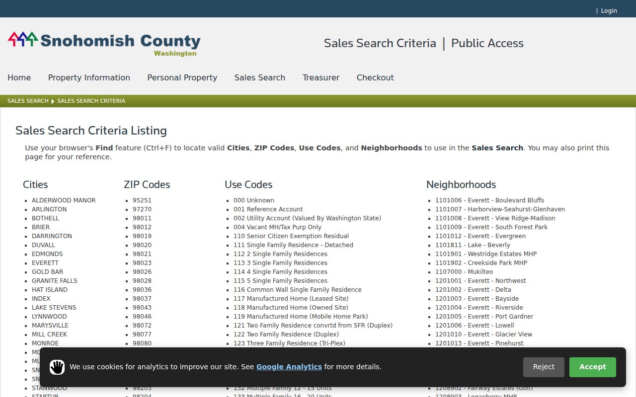
The image reinforces the distinction between a filter and a boundary. City and ZIP are separate controls because each describes a different geography.
| Field | Format | Role in ZIP research |
|---|---|---|
| ZIP | Dropdown | Choose 98012, 98021, or 98036 |
| City | List | Compare BOTHELL with the postal result |
| Neighborhood | Selection | Narrow county appraisal group |
| Property type | Selection | Limit the sales set |
| Sale criteria | Date and value controls | Add a time or transaction filter |
Find Bothell West Records by ZIP
A ZIP-wide result is too broad to establish who lives at one address. Move in stages, keeping the source and date for each result.
- Validate the full address in USPS Lookup and save the returned postal form.
- Choose that ZIP in Assessor Sales Search, adding city or neighborhood only as a separate filter.
- Open the parcel in SCOPI and confirm the site address, parcel ID, and jurisdiction.
- Use the PDS Public Records search with ZIP, address, parcel, permit, or descriptive terms for unincorporated files.
- Narrow to a street and date before requesting a resident-related record from its actual custodian.
PDS is also the address-assignment route for unincorporated land. When no address exists, county materials direct applicants to an ADDR application. For a full named-street trail after the ZIP is narrowed, use the Bothell West street directory.
Bothell West ZIP Boundary Limits
Bothell West is a Census-designated place in Snohomish County, not an incorporated city. Nearby Bothell is a city spanning Snohomish and King counties. The Canyon Park plan also distinguishes city-annexed land from unincorporated areas north of Maltby Road or SR 524. A 98012 or 98021 mailing address can therefore use “Bothell” without proving City of Bothell jurisdiction.
- ZIP code
- A USPS delivery area, not a city limit, tax district, or proof of residence.
- ZIP+4
- Four extra digits that refine mail delivery within a ZIP.
- PO-box ZIP
- A ZIP used mainly for post-office boxes or special delivery.
- Unique ZIP
- A ZIP assigned to one large organization or facility.
- Carrier route
- A delivery path inside a ZIP, not a neighborhood or ownership line.
Keep county first, city field second, and postal ZIP third in research notes. A mailing label then remains useful without being mistaken for legal geography.
Anchor Bothell West ZIP Results
Snohomish County real-property parcel numbers contain 14 digits. SCOPI can display parcel and house-number labels, though labels may change with map scale or overlap. Open the result card before copying a number. Recorder plats and legal descriptions control subdivision or lot identity, while the ZIP remains a mail-routing fact.
If an old address fails, ask PDS or the Snohomish County Auditor about historic legal descriptions. Research found no official Bothell West street-renumbering project, so it would be wrong to assume that every mismatch comes from renumbering. Postal realignment, a changed street form, or a broad newspaper place label may be the cause.
A property result also shows ownership, not every occupant. Move from ZIP to parcel only for a lawful personal purpose, and stop when a record is exempt, redacted, or protected.
Bothell West ZIP Context
Census QuickFacts reports 22,015 people in Bothell West in 2020 and a 2024 estimate of 22,029 across 4.15 square miles. It also reports 7,995 households. Those figures describe the CDP as a whole. They are not per-ZIP resident counts and should not be divided among 98012, 98021, and 98036 without an official geographic crosswalk.
The missing polygon table is an important limit of the Bothell West ZIP code directory. Official sources exposed search options and mailing labels, not a street-by-street intersection between the CDP and each postal area. Use a validated address and parcel map for the exact question rather than turning broad statistics into a guessed local roll.
Research Old Bothell West ZIP Labels
Historical city directories and newspapers can preserve the ZIP used when an issue was printed. Record that value instead of silently replacing it with today's label. Next, check the USPS bulletin history and run both postal forms in property tools. Match the street and legal parcel details before deciding that two records concern the same place.
The method matters near North Creek, Canyon Park, Thrasher's Corner, Mill Creek, and Lynnwood. Local place names can stay stable while postal routing changes. Conversely, a Bothell mailing label can remain even though the property is in unincorporated Snohomish County. The postal name is a search aid, not the final jurisdiction answer.
Use all documented access channels when a web result is unclear. USPS Lookup verifies a current delivery label online. The Assessor and SCOPI supply online parcel context. PDS offers searchable unincorporated permit records, yet its guidance warns that not every file is digitized. Older or missing material may require staff contact or a public-records request under the Washington Public Records Act. A historical postal clue may also require the USPS bulletin archive, a library newspaper, or a directory volume.
Save the input as well as the result. Note whether a portal received a ZIP, city, street address, parcel, or date filter. Record the day searched and any result cap. This makes it possible to explain why the Assessor list, USPS label, and Census place do not match. Each system answered a different question.
A sound ZIP code directory result includes three citations: the USPS result for the delivery label, the county result for parcel or permit geography, and the dated source that connects the address to the research question. If one layer conflicts, do not pick the most convenient answer. Check the effective date, spelling, and whether the portal is showing a mailing address or a site address.
Mailing and site addresses can differ. County records may show a taxpayer mailing line apart from the land's situs address, which means the physical location. A ZIP tied to the taxpayer is not automatically the ZIP of the parcel. Read the field label and result card before copying either value into notes.
For voter material, ZIP is not a complete public resident filter. Washington's disclosed fields and political jurisdictions follow separate rules, and the current county form redirects voter-data requests to the Secretary of State. Do not treat VoteWA registration controls as an open ZIP-wide list. Start from a known, lawful question and use the custodian's current request process.